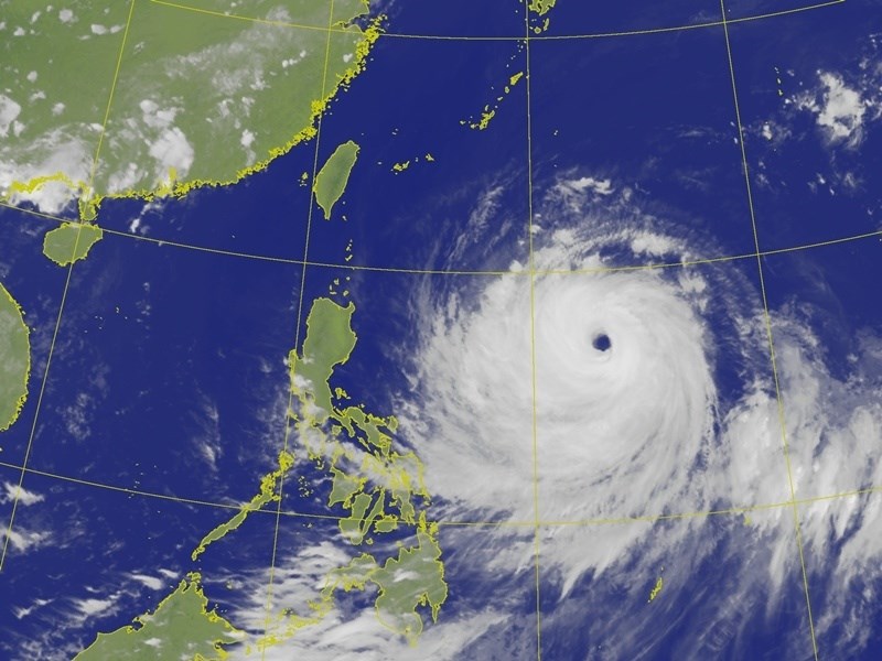
(CNA, Taipei, July 8) - As Super Typhoon Bavi approaches, Taipei City's meteorological team predicted today that the city will enter the storm's radius at 8 PM on July 10. The strongest rainfall is expected between 8 PM on July 10 and 8 PM on July 11, with the city expected to exit the storm's radius after 11 PM on July 11.
The Central Weather Administration stated that Bavi remains a super typhoon with a storm radius of 380 kilometers, making it both strong and large. The current forecast indicates the highest probability of passing near the northeastern coast of Taiwan, but interaction with topography could lead to it coming closer to Taiwan. A sea typhoon warning is expected to be issued as early as the daytime of July 9.
Taipei Mayor Chiang Wan-an visited the Taipei City Disaster Response Center today, chairing a disaster preparedness meeting for the second time in a week. Taipei's meteorological team reported that Typhoon Bavi's intensity continues to increase, with a radius of 350 kilometers. A sea typhoon warning is anticipated to be issued around 2 PM on July 9, and Taipei will enter the storm's radius at 8 PM on July 10.
Regarding the duration of the storm's influence, the meteorological team stated that between 10 PM on July 10 and 2 PM on July 11 will be when the typhoon's center is closest to Taipei City. Flat areas may experience gusts of level 10 to 13, with hourly rainfall rates of 20 mm to 50 mm.
Following this, although still within the storm's radius after 2 PM on July 11, Taipei will experience southerly winds as the typhoon moves to the northwest of the city. Therefore, hourly rainfall and wind gusts will decrease. The city will not exit the storm's radius until 11 PM on July 11, at which point the wind and rain will begin to subside.
The meteorological team's comprehensive assessment estimates the strongest rainfall between 8 PM on July 10 and 8 PM on July 11. Accumulated rainfall in flat areas during this period is projected to reach a maximum of 400 mm, equivalent to extremely heavy rain.
The meteorological team also cautioned that areas such as Yangmingshan, the middle reaches of the Keelung River, and the Feitsui Reservoir catchment area may experience extremely heavy to torrential rain. Particular attention should be paid to the continuous, short-duration heavy rainfall near the eyewall during the typhoon's closest approach, which could last for 3 to 5 hours. (Editor: Lung Po-an) 1150708
Stand with facts, your every donation is a force to protect press freedom
Download the CNA "First News" APP for real-time updates
Text, images, and videos on this website may not be reproduced, publicly broadcast, publicly transmitted, or used without authorization.
FACT BOX
- Source: CNA (Central News Agency)
- Category: 天氣