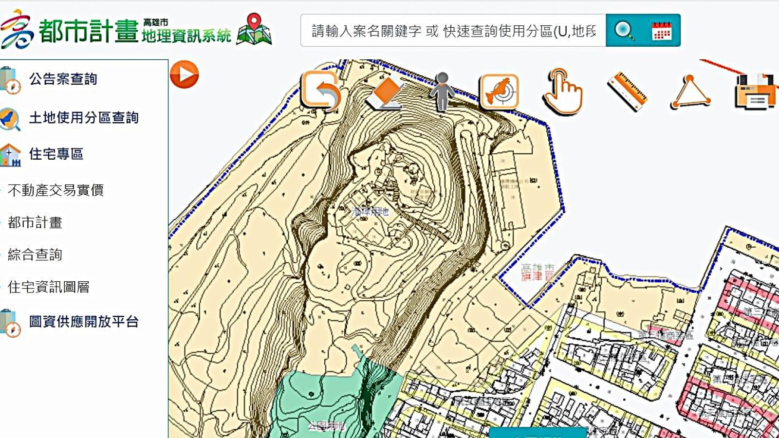
As urban development accelerates rapidly in Kaohsiung, the city's landscape has undergone significant transformation. To accurately capture the latest urban conditions and improve the precision of municipal planning and disaster prevention decisions, the Kaohsiung City Government Urban Development Bureau has completed new topographic surveys for five districts—Nanzih, Zuoying, Gushan, Qijin, and Xiaogang—and will officially launch them on August 20. This marks the first comprehensive map update in over 20 years, utilizing the latest aerial survey technologies to reconstruct high-precision geospatial data. These updated maps will serve as a critical foundation for urban planning, major infrastructure projects, disaster response, and safeguarding citizens’ property rights.
According to the Urban Development Bureau, the previous topographic maps for these five administrative districts were surveyed in 2000 (Minguo Year 89). Since then, extensive developments—including the Kaohsiung MRT, light rail, roads, bridges, and other major infrastructure projects—have dramatically altered the city’s spatial layout. To ensure accuracy, this re-survey adopted digital aerial photogrammetry, using specialized airborne cameras and precision instruments to collect up-to-date data. Professional staff then conducted on-site verification, meticulously confirming terrain features such as buildings, roads, and waterways to ensure the map data closely reflects real-world conditions.
The new topographic maps are highly detailed, covering artificial structures such as buildings and walls, transportation networks including roads, railways, metro lines, and light rail systems, as well as natural features like rivers, water bodies, vegetation, contour lines, topographical landmarks, and administrative boundaries. This comprehensive dataset provides government agencies and stakeholders with more accurate spatial information.
Integration of Topographic Maps, Urban Planning Stake Maps, and Cadastral Maps – 'Three Maps as One'
The Urban Development Bureau emphasizes that precise topographic maps are essential for urban planning and administrative management. Reliable base maps are indispensable for urban planning, public infrastructure development, and related administrative procedures. Land administration units can overlay topographic maps with urban planning stake maps and cadastral maps, enabling 'three maps as one' integration. This enhances the accuracy of cadastral subdivision and zoning classification under urban plans, further protecting citizens’ property rights.
Moreover, topographic maps are vital tools for major engineering projects and disaster preparedness. When planning roads, railways, bridges, or dams, engineers can analyze terrain and slope using elevation and contour data to estimate earthwork volumes. During heavy rainfall, flooding, or landslide events, terrain data supports flood inundation simulations and hazard potential analysis, helping identify areas prone to collapse, debris flows, or flooding. This information aids in disaster preparedness, emergency response, and mitigation decision-making.
Additionally, topographic maps hold significant value in preserving the history of urban development. Maps produced in different eras faithfully record the city’s appearance at the time. By comparing historical map data, one can visualize Kaohsiung’s urban growth and landscape changes over time. These records can also serve as evidence of the historical existence of older buildings, providing tangible assistance to residents handling related legal or property matters.
The Urban Development Bureau states that the updated topographic maps will be available in two formats: 'CAD electronic files' and 'paper copies.' Residents can apply in person at the 6th floor of the Siwei Administrative Center of the Kaohsiung City Government Urban Development Bureau, where walk-in service is provided with immediate issuance upon payment. For those who only need to view the data, free online access is available through the bureau’s 'Urban Planning Geographic Information System.'
The bureau reminds the public that the latest edition of the topographic maps will officially go live on August 20 and encourages active use by citizens and stakeholders. For inquiries regarding map data applications, please contact the dedicated hotline at (07) 336-8333, extension 2989, where specialists will provide detailed assistance.
FACT BOX
- Source: PR Times
- Category: News