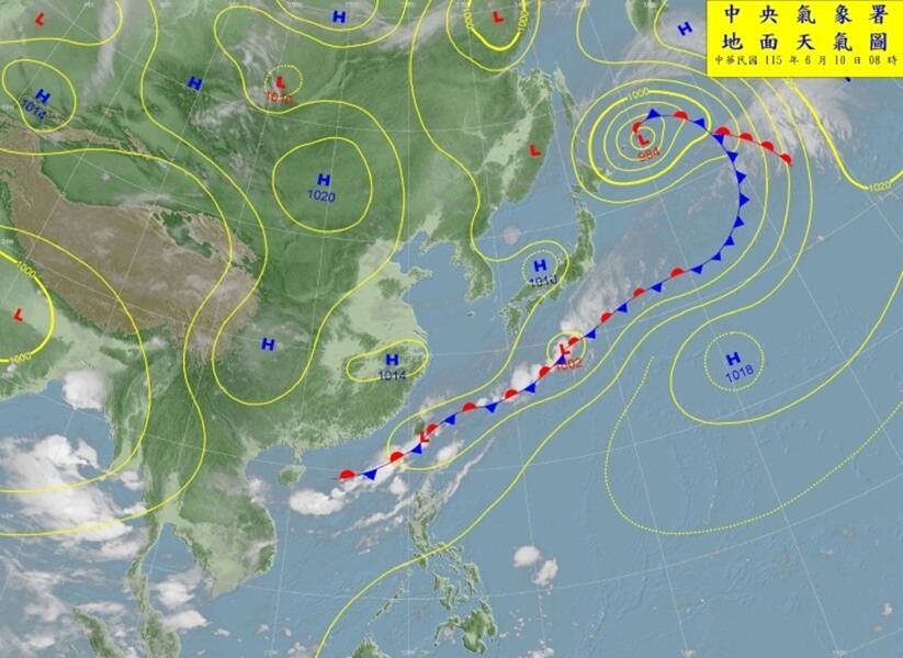
(CNA, Taipei, June 10, Reporter: Chang Hsiung-feng) The Central Weather Administration (CWA) stated that today, the western half of Taiwan, the Hualien area, and the mountainous regions of Taitung should still be on alert for localized heavy rain, while the southern mountainous areas should be wary of short-duration torrential rain. From tomorrow until the 16th, a weather front will linger and shift north and south, and from the 14th to the 16th, the western half and the mountainous areas of the eastern half should continue to guard against localized torrential rain.
CWA forecaster Li Meng-hsuan stated at a press conference this morning that the front is gradually moving to southern Taiwan and the southwest monsoon is also weakening, so the "0608 stationary front and southwest monsoon torrential rain event" was lifted at 8 a.m.
Reviewing this torrential rain event, Li pointed out that starting from the 8th, as the front approached and the southwest monsoon strengthened, there was significant rainfall in areas south of Yunlin and in the greater Taipei area. This was especially true in the greater Taipei area, where significant afternoon thermal convection after noon led to the day's highest cumulative rainfall being recorded in Wanli District, New Taipei City.
Li further explained that on the 9th, with the front over Taiwan and the influence of the southwest monsoon, it was the day with the most significant rainfall. Localized heavy rains occurred throughout the region. Yesterday's highest cumulative rainfall was 292 mm in Liugui, Kaohsiung, mainly because a more significant convective system moved into southern Taiwan's land areas after noon yesterday, causing short-duration intense rainfall.
Li stated that this morning, the southwest monsoon gradually weakened and moved south to the Bashi Channel, while the front also moved to the area from southern Taiwan to the Hengchun Peninsula. Therefore, the southern mountainous areas and the southeastern region may still experience relatively high rainfall, while other areas from the central region northward will generally remain moist. Overall, today, the western half, the Hualien area, and the mountainous areas of Taitung should still be on alert for localized heavy rain, and the southern mountainous areas for short-duration torrential rain.
Li said that tomorrow, the 12th, the front will gradually move north again from the Bashi Channel onto the island of Taiwan, leading to increased rainfall. Localized heavy rain is possible in the western half and the mountainous areas of the eastern half. On the 13th, the front will move further north to the northern sea, and Taiwan will be in a southwesterly wind environment, causing the rain to ease somewhat. However, the windward central and southern regions may still need to be cautious of intermittent brief showers or thunderstorms.
Li mentioned that from the 14th to the 16th, the front will approach Taiwan again, also in a southwesterly wind environment, bringing localized heavy rain or short-duration torrential rain to the western half and mountainous areas of the eastern half. (Editor: Chang Ming-kun) 1150610
FACT BOX
- Source: CNA (Central News Agency)
- Category: 事件