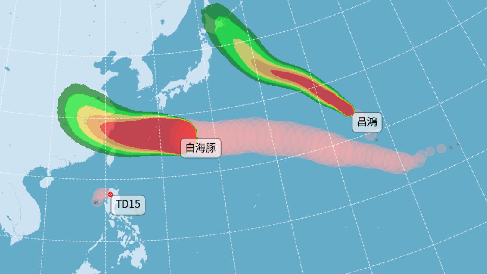
Typhoon Dolphin, currently located about 1,580 kilometers east of Taiwan, is moving westward with a clear eye and expansive convective cloud bands. Guided by the Pacific high-pressure system, it will continue on a westward trajectory, passing south of the Ryukyu Islands before entering the seas north of Taiwan by Friday. There is a high chance that the typhoon's wind field will graze the northern coastal waters. Although the storm may weaken slightly upon approach, its large wind radius combined with the westward track shift significantly increases the threat to Taiwan.
According to CWB forecaster Cheng Chieh-jen, Saturday through Monday will be the closest approach period. Influenced by the outer circulation, localized torrential rains are expected in northern mountainous areas, with rainfall intensity possibly reaching from 'purple' (very heavy) to 'white' (extremely intense). Parts of central and northern Taiwan, including Matsu, will also experience heavy downpours. From Tuesday to Wednesday, as the typhoon moves away, the weather pattern will shift to a southwest monsoon flow, bringing scattered showers to central and southern regions, while other areas face isolated thunderstorms in the afternoons.
Currently, three typhoons exist across the Northwest Pacific and South China Sea: Whale, which is dissipating today, and Chang-hong, formed yesterday—neither affecting Taiwan’s weather. The main concern remains Typhoon Dolphin. Latest ensemble numerical forecasts indicate that Dolphin will adjust its path northwestward under environmental steering flows, most likely skimming northern Taiwan’s waters before making landfall in Zhejiang Province, China.
Meteorological expert Professor Lin warned on Facebook: 'Father’s Day is washed out.' If Dolphin maintains its current speed, direction, and structural intensity, the probability of issuing a sea typhoon warning exceeds 85%. The warning is expected to be issued on the afternoon of the 7th, covering northern and northeastern waters of Taiwan, and will likely remain in effect until the afternoon of the 10th. Rainfall predictions show island-wide precipitation chances, with August 8th and 9th being the most volatile period for rain impacts.
FACT BOX
- Source: PR Times
- Category: News